U.S. Maps - Lesson for Grade 3, Chapter - American Geography
In the "U.S. Maps" lesson, a part of the American Geography chapter, third-grade students embark on an exciting journey across the diverse landscapes of America. By engaging in activities like the US Mountain Ranges Worksheet and the U.S. Lakes and Rivers Worksheet, students will learn to identify and locate key geographical features of the United States. They will discover the majesty of the Rocky Mountains, the expansive Great Lakes, the vital Mississippi River, and more. This knowledge is not only fundamental for understanding the physical makeup of the country but also for appreciating the role these features play in the climate, economy, and history of the United States.
Understanding geography is crucial for young learners as it builds a foundation for more advanced concepts in history, science, and environmental studies. It nurtures spatial thinking, helping students visualize and interpret the world around them. Moreover, by learning about the geographic diversity of their country, students develop a sense of national identity and appreciation for natural resources and landscapes. This lesson, therefore, is an essential stepping stone in cultivating informed, curious, and environmentally conscious citizens.
-
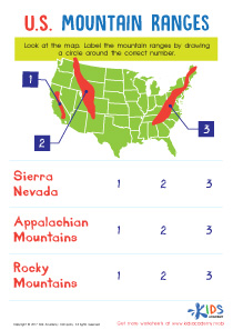
Activity 1 / US Mountain Ranges Worksheet
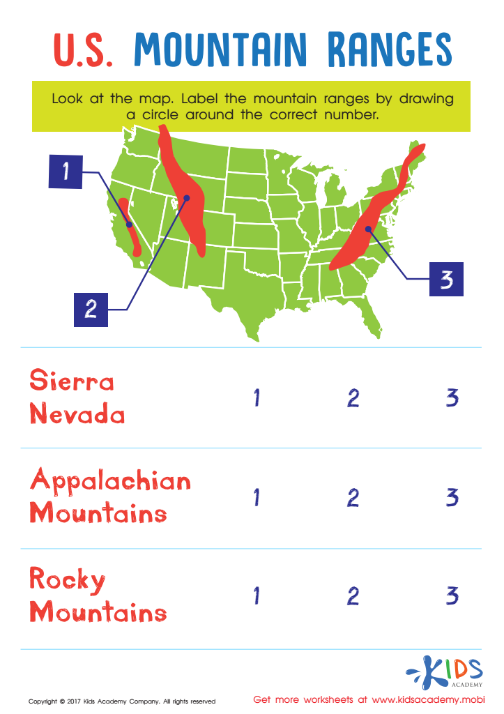
Introduce your little learner to some of the most well-known land masses in the United States using this U.S. Mountain Ranges worksheet!
This short, but meaningful worksheet will teach your child not only to recognize the major mountain ranges, but to locate them using a map or illustration to hone budding map skills! -
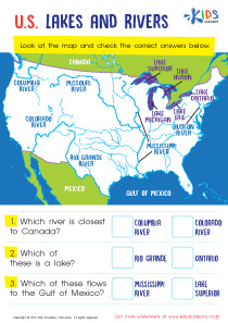
Activity 2 / U.S. Lakes and Rivers Worksheet
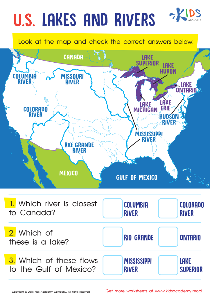
Let your little geographer get some practice with the rivers and lakes of the United States! This colorful PDF shows various primary lakes and rivers across the country and asks them to identify the differences between rivers and lakes. Additionally, they'll work with beginning cardinal directions as they answer questions about proximities and familiarize themselves with well-known U.S. geographical landmarks.