Understanding maps Worksheets for Kids
1 filtered results
-
From - To
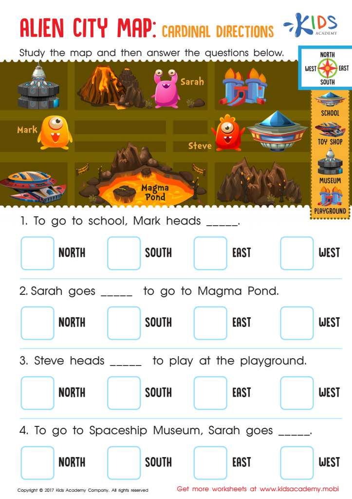
Alien City Map: Cardinal Directions Worksheet
Question/Answer
What does the Understanding maps skill mean when it comes to Grade 2 Geography learning?
The Understanding maps skill in Grade 2 Geography involves teaching students how to read and interpret basic maps. It includes recognizing simple map symbols, understanding directions (north, south, east, west), and identifying key features like landforms and bodies of water on maps.
How to train the Understanding maps skill in Grade 2 students learning about Geography?
To train Grade 2 students in understanding maps, start by introducing basic map elements like the compass rose, legend, and scale. Use simple, colorful maps of familiar places. Incorporate interactive activities like creating maps of their classroom or home. Employ storytelling to explain the purpose of different maps.
Why is the Understanding maps skill important for Grade 2 students?
The Understanding maps skill is crucial for Grade 2 students as it lays the foundation for spatial thinking, helps them grasp basic geography, and enhances their ability to navigate and understand the world around them. It also introduces them to concepts of direction, scale, and symbolic representation, fostering critical thinking and problem-solving skills from an early age.