U.S. Regions - Lesson for Grade 3, Chapter - American Geography
In the "U.S. Regions" lesson, part of the American Geography chapter for Grade 3 students, young learners will embark on an exciting journey through the diverse landscapes and cultures that make up the United States of America. This lesson is designed to introduce students to the concept of geographical regions and how the United States is divided into five distinct areas: the Northeast, Southeast, Midwest, Southwest, and West.
Through engaging activities such as the "Regions of the USA," "US Regions Coloring Page Worksheet," "5 U.S. Regions Worksheet," and "Regions of the USA Worksheet," students will not only learn about the unique characteristics, climates, and landmarks of each region but also enhance their geography skills, understanding of cultural diversity, and appreciation for the vastness of the U.S.
Understanding the different regions of the U.S. is important because it helps students grasp the complexity and diversity of the country's geography and cultures. It promotes a sense of national identity and unity while also appreciating the differences that make each region unique. This foundational knowledge serves as a crucial building block for their further studies in geography, history, and social sciences.

-
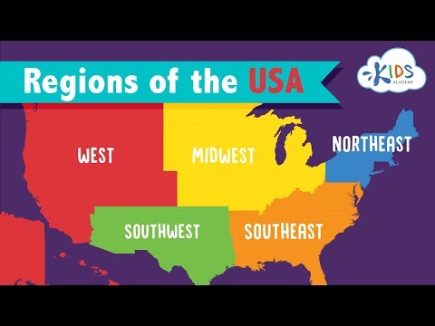
Activity 1 / Regions of the USA
-
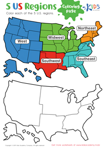
Activity 2 / US Regions Coloring Page Worksheet

The United States is geographically broken up into five major regions. Each region has its own location and states, and each region is known for different things it produces and offers to our country. Let your young statesmen and stateswomen enjoy coloring the different regions: the Southeast, the Southwest, the West, the Midwest, and the Northeast and gain better understanding of where each region is on a map.
-
Activity 3 / 5 U.S. Regions Worksheet

Before starting this worksheet, it might be a good idea to get your students familiarized with the states and their capitals in your country. This way, they would not encounter any strange words in the exercise. Now, look at this map of the United States with your students. Can they repeat some of the state names on the map? Ask your kids to carefully study the map, and then draw a line to the region where each state is located.
-
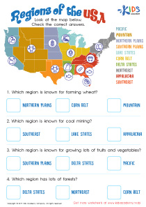
Activity 4 / Regions of the USA Worksheet
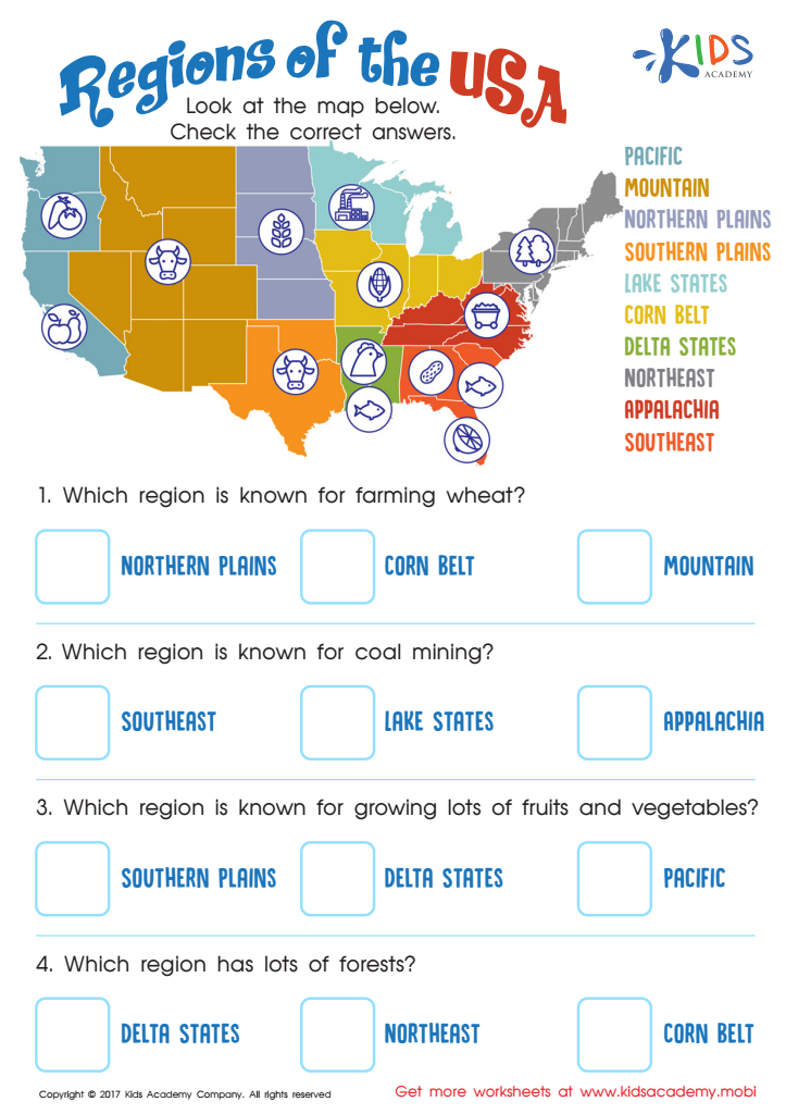
Your child knows the US is made up of different states, but what about the different geographical regions that make our vast country so great?
Each region of the United States has its own culture and purpose. Teach your child about the country’s regions and what makes them tick with this geographic regions of the United States worksheet!


