Map reading skills Normal Worksheets for 7-Year-Olds
8 filtered results
-
From - To
Enhance your child's map reading skills with our engaging worksheets designed specifically for 7-year-olds! Our collection features age-appropriate activities that introduce essential concepts like legends, scale, and cardinal directions. These printable worksheets are perfect for reinforcing geography knowledge while making learning interactive and fun. Children will develop vital skills as they practice reading maps, identifying landmarks, and navigating routes. Ideal for classroom use or at-home learning, our resources support your child's educational journey and spark their curiosity about the world. Start your child on the path to becoming an adept map reader today with our thoughtfully crafted worksheets!

5 U.S. Regions Worksheet
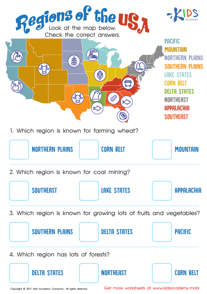
Regions of the USA Worksheet

Seven Continents Worksheet

World Continents Worksheet
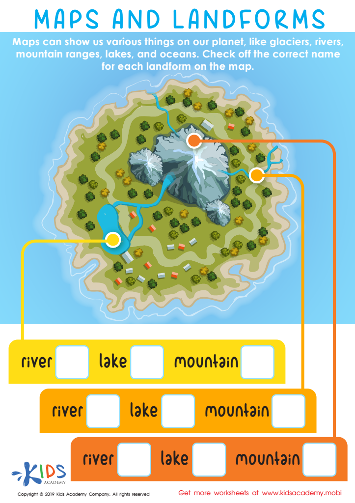
Maps and Landforms Worksheet

US Regions Coloring Page Worksheet

Cardinal Directions Printable
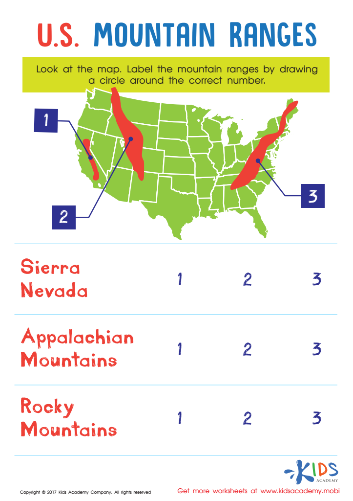
US Mountain Ranges Worksheet


Map reading skills are essential for 7-year-olds as they lay the foundation for critical thinking, spatial awareness, and independence. At this age, children are naturally curious about their surroundings. By learning how to read maps, they enhance their understanding of geography and gain valuable skills that extend beyond the classroom.
Firstly, map reading promotes cognitive development. It teaches children to interpret symbols, understand directions, and recognize patterns, which are all vital skills for their overall learning journey. Understanding spatial relationships also aids in subjects like math and science, as children learn to visualize distances and areas.
Moreover, map skills encourage independence and confidence. As children learn to navigate through maps, they become more self-reliant when it comes to exploring their environments. This independence fosters critical life skills, such as problem-solving and decision-making.
Finally, in today’s digital world, where GPS and digital maps dominate, recognizing the importance of traditional map reading nurtures a deeper understanding of navigation. Teachers and parents should prioritize map reading in early education, enriching children's learning experiences and preparing them for future challenges in an increasingly complex world.