Understanding longitude Worksheets for Kids
1 filtered results
-
From - To
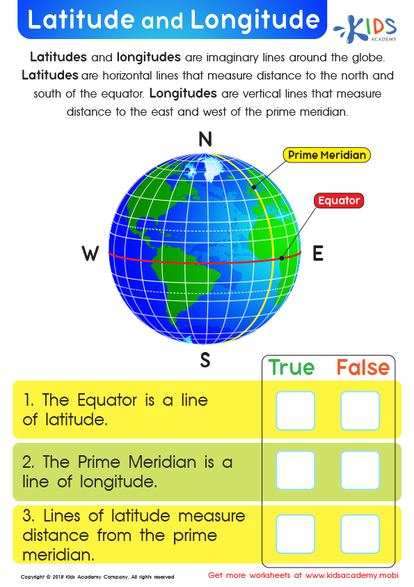
Latitude and Longitude Worksheet
Question/Answer
What does the Understanding longitude skill mean when it comes to Grade 2 Geography learning?
In Grade 2 Geography, the Understanding longitude skill involves teaching students the basic concept of longitude as the imaginary lines that run from the North Pole to the South Pole on a map or globe.
How to test a Grade 2 student’s Understanding longitude skills?
To test a Grade 2 student's understanding of longitude, create a simplified world map with major longitudinal lines marked (e.g., Prime Meridian, 45° E/W). Ask the student to identify these lines, explain the concept of measuring east or west from the Prime Meridian, and use basic examples to show how longitude affects time differences between places.
What are some effective activities to train students’ Understanding longitude skill when teaching them about Geography?
Engage students with interactive globe exercises, showing how longitude lines run from pole to pole. Use map-making projects focused on drawing and labeling longitudes. Incorporate digital tools or apps for virtual navigation across longitudes. Practice calculating time differences between various longitudes to enhance practical understanding. Lastly, storytelling that involves travel across different longitudes can make learning more relatable and memorable.