Identifying oceans Worksheets for Kids
1 filtered results
-
From - To
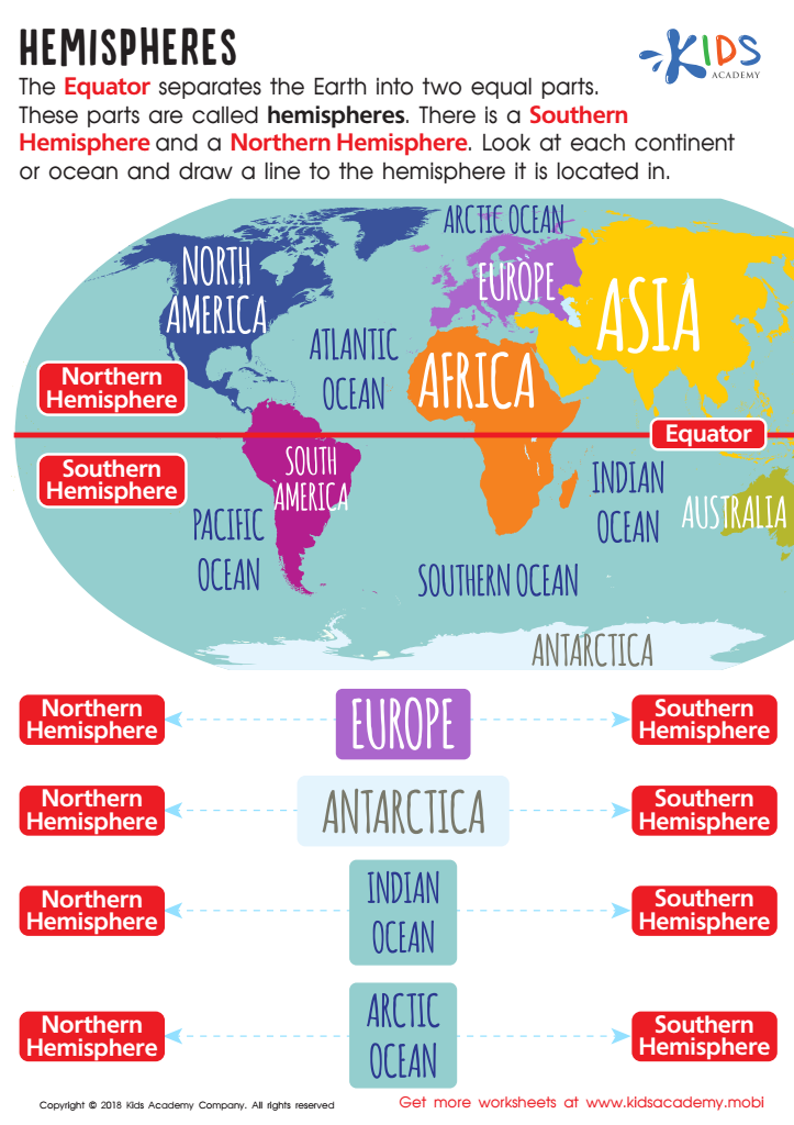
Hemispheres Worksheet
Question/Answer
What does the Identifying oceans skill mean when it comes to Grade 3 Geography learning?
The Identifying oceans skill in Grade 3 Geography involves teaching students to recognize, name, and locate the five major oceans of the world: the Atlantic, Pacific, Indian, Southern, and Arctic Oceans. This skill is fundamental for developing their understanding of the Earth's geography, emphasizing the importance of oceans in global ecosystems, climate, and human activities.
How does the mastery of the Identifying oceans skill affect a student's performance at an early age?
Mastery of the Identifying Oceans skill at an early age positively impacts a student's performance by enhancing their geographical knowledge, spatial thinking, and understanding of global interconnectivity. It lays the foundation for advanced geographical studies, improves cognitive mapping skills, and fosters a sense of curiosity about the world, contributing to a well-rounded educational development.
Why is the Identifying oceans skill important for Grade 3 students?
Identifying oceans is important for Grade 3 students because it lays the foundational knowledge for understanding Earth's geography, enhances spatial thinking, and introduces the concept of interconnectedness of the world's waters. This skill also paves the way for learning about different cultures, ecosystems, and the importance of environmental conservation, fostering a global perspective from an early age.