Understanding topography Worksheets for Kids
1 filtered results
-
From - To
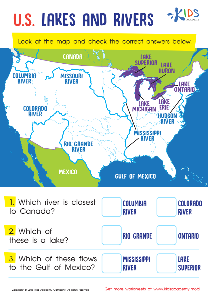
U.S. Lakes and Rivers Worksheet
Question/Answer
What are some effective activities to train students’ Understanding topography skill when teaching them about Geography?
To train students in understanding topography, effective activities include using 3D models or virtual reality tools for immersive experience, contour drawing exercises on maps, creating physical models with clay or sand, organizing field trips to nearby geographical features, and employing interactive online mapping tools such as Google Earth to explore and analyze various landscapes and their topographical elements.
Why is the Understanding topography skill important for Grade 3 students?
The Understanding topography skill is important for Grade 3 students because it lays the foundation for geographical literacy, enhances spatial thinking, and helps them comprehend the relationship between landforms, climate, and human activities. This knowledge fosters a deeper understanding of the environment and promotes critical thinking skills necessary for comprehending maps and navigating the world around them.
How to test a Grade 3 student’s Understanding topography skills?
To test a Grade 3 student's understanding of topography skills, provide a simple topographic map and ask them to identify basic features such as hills, valleys, rivers, and lakes. Additionally, have them demonstrate understanding by having them create simple elevation profiles from the map or model basic landforms with clay or playdough.