Map reading skills Normal Social Studies Worksheets for Ages 3-7
8 filtered results
Difficulty Level
Grade
Age
-
From - To
Subject
Activity
Standards
Explore our engaging Map Reading Skills worksheets tailored for children ages 3-7! Designed to introduce young learners to essential social studies concepts, these worksheets help develop spatial awareness and navigation skills. Through fun activities, kids will learn to recognize symbols, read simple maps, and understand directions in a playful manner. Our resource promotes critical thinking and boosts confidence as children discover their environments. Ideal for classroom use or at-home learning, these worksheets align with educational standards, ensuring your little ones gain valuable skills while having fun. Start their map mastery journey today and watch their knowledge of geography flourish!
Favorites
With answer key
Interactive

5 U.S. Regions Worksheet
Familiarize students with states & capitals in your country before starting. Look at the map and ask kids to name some states. Then have them draw a line to the region each state is located in. This'll help them recognize the different places and make the exercise easier.
5 U.S. Regions Worksheet
Worksheet
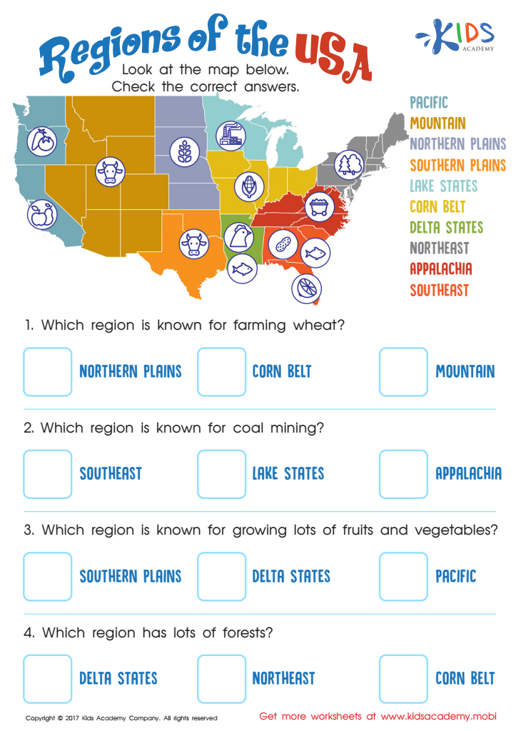
Regions of the USA Worksheet
Help your child explore the US with this regions of the United States worksheet! They'll learn about the diverse cultures, climates and purposes of each region. Make geography and US history fun with this educational exercise!
Regions of the USA Worksheet
Worksheet

Seven Continents Worksheet
Geography teaches kids about the world! Encourage exploration with a seven continents worksheet - it'll help your child identify each continent using fun shapes.
Seven Continents Worksheet
Worksheet

World Continents Worksheet
Help expand your child's knowledge of the world with this fun worksheet! It features goofy shapes to identify each continent, making learning the seven continents fun and memorable.
World Continents Worksheet
Worksheet

US Regions Coloring Page Worksheet
Our great nation is split into five distinct regions: Southeast, Southwest, West, Midwest, and Northeast. Each is known for its own special offerings and states. Let your kids have fun learning about the regions with a coloring activity! It's a great way for them to understand where each region stands on the map.
Download (PDF)
 Assign to My Students
US Regions Coloring Page Worksheet
Worksheet

Cardinal Directions Printable
Perfect for fall, let's go to Transylvania with Count Dracula to learn cardinal directions. This printable worksheet introduces the compass rose and offers valuable practice. Kids will love the fun vampire theme! Get them motivated and help them discover the world with this spooky worksheet.
Cardinal Directions Printable
Worksheet
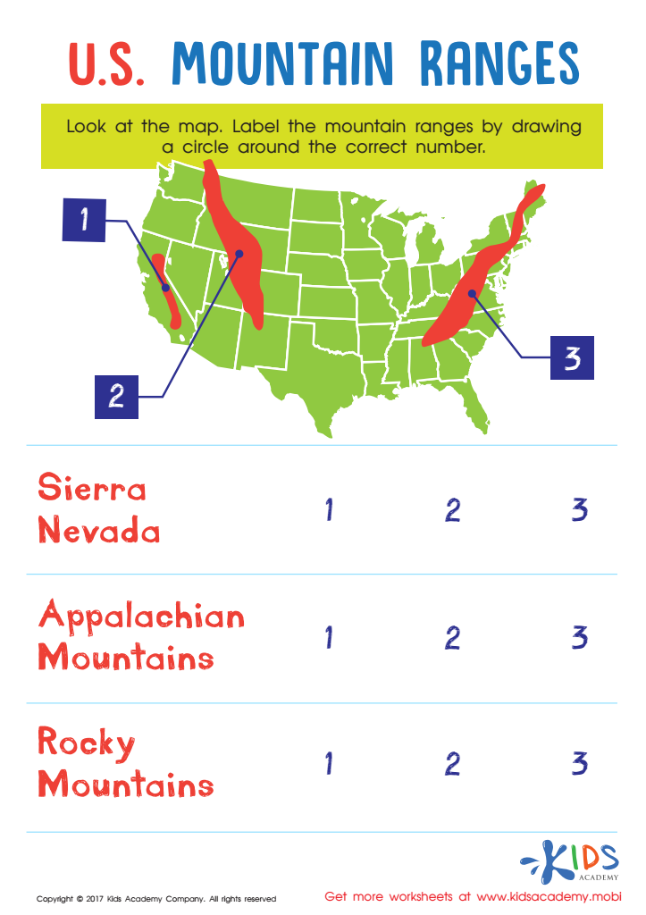
US Mountain Ranges Worksheet
Introduce your little one to the U.S. with this Mountain Ranges worksheet! It'll help them recognize the major ranges and locate them on a map, sharpening their map skills.
US Mountain Ranges Worksheet
Worksheet

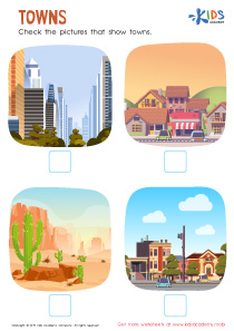
Towns Worksheet
Towns are generally quiet and safe, making them attractive for young families. Cities have more people, businesses and tall buildings. Roads are busy, and there is often plenty to do and see. Help your kids check which pictures in this worksheet show towns.
Towns Worksheet
Worksheet
Join Kids Academy for Free
Who is primarily going to use this learning content?


.jpg)


Parents and teachers should prioritize map-reading skills in young children, ages 3-7, because these skills lay the foundation for critical thinking, spatial awareness, and navigation abilities essential for their development. At this age, children are naturally curious about their surroundings, and incorporating map-reading into social studies fosters this curiosity. By engaging with maps, children learn to recognize symbols and understand how different places are related to each other, enhancing their comprehension of geography.
Additionally, map reading promotes language development as children learn relevant vocabulary, such as "north," "south," "near," and "far." This activity also encourages cooperation and collaboration in group settings, as children can work together to find locations or complete scavenger hunts using maps. These cooperative skills are vital for social development and community engagement.
Furthermore, understanding maps helps build problem-solving abilities as children navigate through physical spaces or plan routes. In a world where navigation tools are often digital, maintaining foundational skills in traditional map reading ensures children become adaptable, resourceful learners. Ultimately, fostering map-reading skills supports a well-rounded education, teaching children not just about geography but also how to perceive and interact with the world around them.