Map reading skills Normal Worksheets for Ages 6-7
8 filtered results
-
From - To
Enhance your child's map reading skills with our engaging worksheets designed specifically for ages 6-7. These normal worksheets focus on helping young learners develop essential skills in navigation, interpretation, and visual comprehension related to maps. Each activity is thoughtfully crafted to encourage critical thinking and improve spatial awareness while making the learning process fun and interactive. Suitable for home or classroom use, these worksheets include a variety of exercises, such as identifying landmarks, understanding scales, and following directions. Foster your child's curiosity and confidence in map reading today with our user-friendly tools designed for early learners!

5 U.S. Regions Worksheet
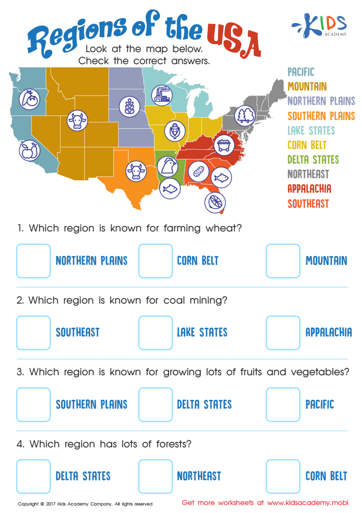
Regions of the USA Worksheet

Seven Continents Worksheet

World Continents Worksheet
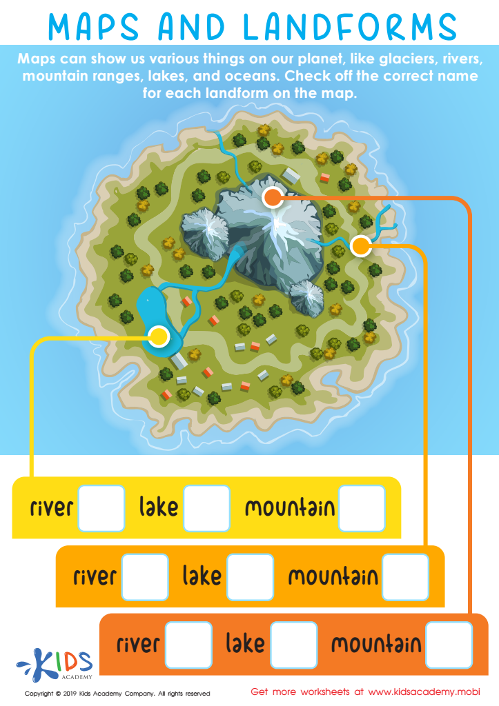
Maps and Landforms Worksheet

US Regions Coloring Page Worksheet

Cardinal Directions Printable
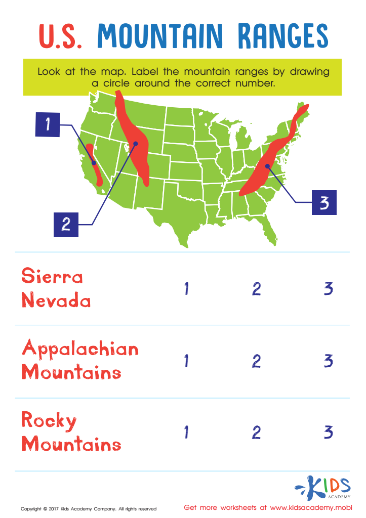
US Mountain Ranges Worksheet


Map reading skills are essential for children aged 6-7, as they provide foundational abilities that contribute to cognitive development and spatial awareness. At this age, kids are naturally curious about their surroundings, and engaging them in map reading helps enhance their observational skills and critical thinking. Understanding maps encourages children to interpret symbols, scale, and navigation, promoting problem-solving abilities that are crucial for academic advancement.
Moreover, map reading is a practical life skill. It helps young learners grasp their environment, making them more confident in exploring new places. As children learn to follow directions and recognize landmarks, they build a sense of independence and safety. Additionally, this skill fosters early geography understandings, paving the way for a greater appreciation of culture, diversity, and global interconnections.
Finally, incorporating map reading into learning makes education interactive and enjoyable, propelling student engagement. It encourages collaborative activities with peers and family, enriching communication and teamwork skills. Overall, fostering map reading abilities in early education not only enhances classroom learning but also prepares children for lifelong learning and navigation in an increasingly complex world. Thus, both parents and teachers should prioritize the development of these vital skills.