Map reading Normal Social Studies Worksheets for Ages 7-9
3 filtered results
Difficulty Level
Grade
Age
-
From - To
Subject
Activity
Standards
Discover our engaging "Map Reading Normal Social Studies Worksheets" tailored specifically for children aged 7-9! These expertly crafted worksheets are designed to enhance young learners' understanding of maps and their navigational skills. Through fun activities such as identifying symbols, understanding directions, and interpreting legends, students will develop essential geography knowledge and critical thinking. Our resources are printable and easy to integrate into any classroom or home learning environment, making map reading an enjoyable and interactive experience. Perfect for supporting social studies curricula, these worksheets encourage curiosity about the world while building foundational skills for future exploration. Start your journey today!
Favorites
With answer key
Interactive
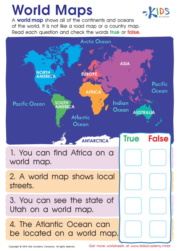
World Maps Worksheet
Help your young geographer learn about world maps. Show them that it displays all the oceans, continents and is distinct from other maps. Challenge them to answer the true/false questions on this free worksheet, and help them become a global citizen who understands the purpose of world maps.
World Maps Worksheet
Worksheet
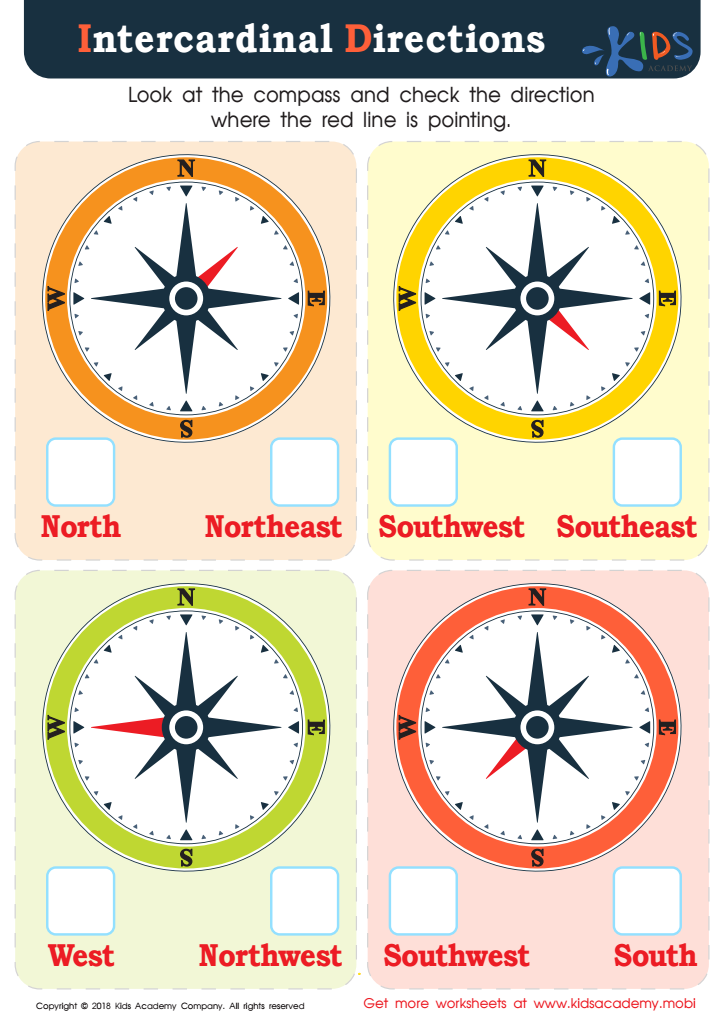
Intercardinal Directions Worksheet
Young students often don't get to practice cardinal and intercardinal directions in the digital age, but it's an important social studies and geography concept to learn. This PDF provides colorful compasses for them to practice with, giving them a real-world skill for common curriculum and independent living.
Intercardinal Directions Worksheet
Worksheet
Join Kids Academy for Free
Who is primarily going to use this learning content?


Map reading is a vital skill for children aged 7-9, particularly in the context of social studies, as it fosters critical thinking, spatial awareness, and real-world connections. For parents and teachers, caring about this skill transcends mere academic development; it nurtures essential life competencies.
First and foremost, map reading teaches children how to interpret and understand their surroundings. In a rapidly digitalized world, being able to navigate using maps reinforces problem-solving skills and decision-making abilities. Children learn to identify key landmarks, relate distances, and understand geographic symbols, which promotes cognitive growth.
Moreover, engaging with maps cultivates a sense of place and belonging. Understanding geographical contexts allows children to connect with their community, exploring local histories and cultures. It empowers them to engage in meaningful discussions about diverse environments and socio-economic factors that shape their lives.
Additionally, lessons in map reading facilitate collaborative learning. Working together on map-related activities encourages teamwork, communication, and critical discussions among peers, traits that are invaluable in and out of school.
In essence, when parents and teachers prioritize map reading in social studies, they not only enhance academic performance but also equip children with lifelong skills that bolster independence and confidence in their exploration of the world.