Map reading skills Social Studies Worksheets for Ages 3-6
8 filtered results
Difficulty Level
Grade
Age
-
From - To
Subject
Activity
Standards
Boost your child's navigational confidence with our engaging "Map Reading Skills" Social Studies Worksheets for Ages 3-6. Designed to make learning fun, these age-appropriate printables introduce basic map concepts, symbols, and directions, fostering essential early geographic skills. Through interactive activities, young learners improve their spatial awareness while developing critical thinking and problem-solving abilities. These worksheets also support reading readiness by integrating simple instructions and labels. Ideal for parents and educators, our high-quality resources create a solid foundation for continued social studies education, encouraging curiosity and exploration. Start your child's journey to becoming a map master today!
Favorites
With answer key
Interactive

5 U.S. Regions Worksheet
Familiarize students with states & capitals in your country before starting. Look at the map and ask kids to name some states. Then have them draw a line to the region each state is located in. This'll help them recognize the different places and make the exercise easier.
5 U.S. Regions Worksheet
Worksheet
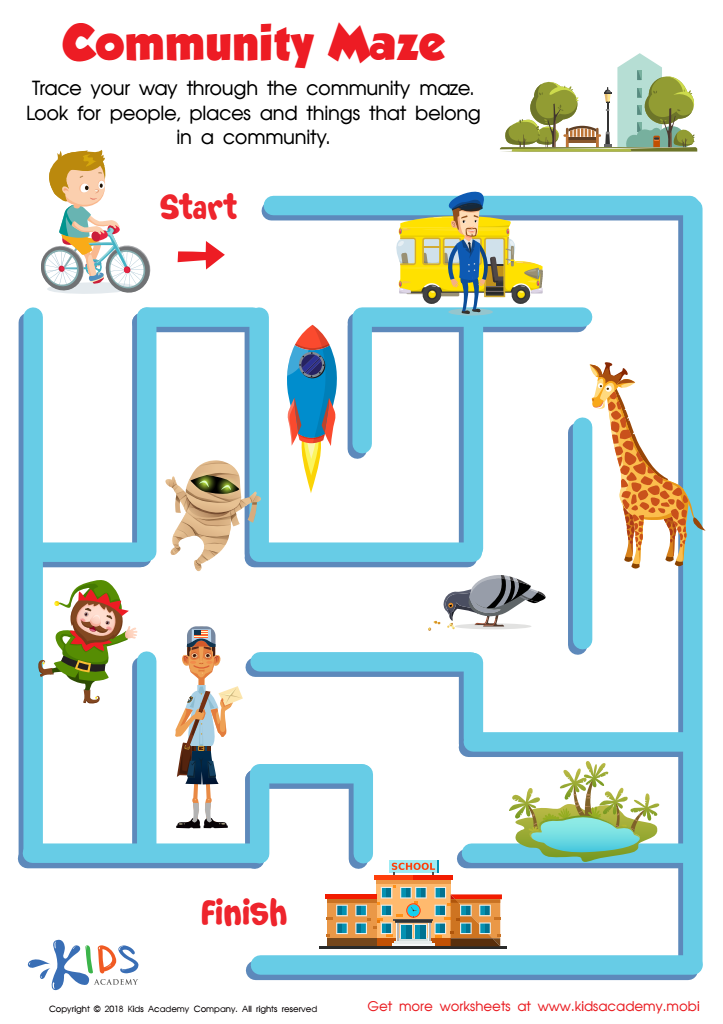
Community Maze Worksheet
Your kids will have a blast as they use their fine motor skills to trace their way through the community maze worksheet. Plus, they'll enjoy meeting people, places, and creatures to sort out who and what belong in a community and who and what don't! Help their friend bike to the neighborhood school and reinforce what life is like in a community.
Community Maze Worksheet
Worksheet

Seven Continents Worksheet
Geography teaches kids about the world! Encourage exploration with a seven continents worksheet - it'll help your child identify each continent using fun shapes.
Seven Continents Worksheet
Worksheet

World Continents Worksheet
Help expand your child's knowledge of the world with this fun worksheet! It features goofy shapes to identify each continent, making learning the seven continents fun and memorable.
World Continents Worksheet
Worksheet
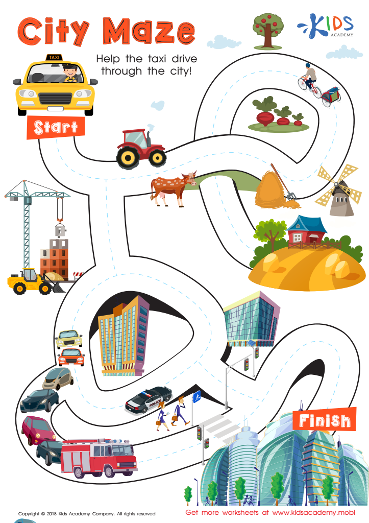
City Maze Worksheet
Kids love mazes! This free PDF city maze worksheet is sure to be a hit. Help your friend the taxi driver get through the maze, following traceable lines through different communities to the big city. It's a fun and challenging way to practice fine motor skills and succeed!
City Maze Worksheet
Worksheet

US Regions Coloring Page Worksheet
Our great nation is split into five distinct regions: Southeast, Southwest, West, Midwest, and Northeast. Each is known for its own special offerings and states. Let your kids have fun learning about the regions with a coloring activity! It's a great way for them to understand where each region stands on the map.
Download (PDF)
 Assign to My Students
US Regions Coloring Page Worksheet
Worksheet

Cardinal Directions Printable
Perfect for fall, let's go to Transylvania with Count Dracula to learn cardinal directions. This printable worksheet introduces the compass rose and offers valuable practice. Kids will love the fun vampire theme! Get them motivated and help them discover the world with this spooky worksheet.
Cardinal Directions Printable
Worksheet

Towns Worksheet
Towns are generally quiet and safe, making them attractive for young families. Cities have more people, businesses and tall buildings. Roads are busy, and there is often plenty to do and see. Help your kids check which pictures in this worksheet show towns.
Towns Worksheet
Worksheet
Join Kids Academy for Free
Who is primarily going to use this learning content?


Map reading skills are essential for young children's cognitive and social development. Introducing these skills to children between the ages of 3 to 6 allows them to understand and interact with their world in meaningful ways. During this developmental stage, children are curious and eager to explore their environment, and maps provide a tangible tool to facilitate this exploration. They help build spatial awareness by teaching kids how to visualize locations and navigate spaces, which can translate to better problem-solving skills.
Furthermore, maps expose children to basic geographic concepts such as symbols, directions, and landmarks, laying the foundation for more advanced social studies education. This early exposure can spark an interest in geography, cultures, and global awareness, cultivating a sense of curiosity about the wider world. By integrating map reading into social studies, children also learn about community structures, developing an understanding of where they fit within their immediate and global communities.
Parents and teachers should prioritize this skill to help young learners expand their vocabulary, improve memory through the recognition of shapes and patterns, and foster attention to detail. Importantly, collaborative map activities can also promote social skills such as cooperation, communication, and shared learning experiences, contributing to holistic educational development.