Map reading skills Social Studies Worksheets for Ages 4-6
8 filtered results
Difficulty Level
Grade
Age
-
From - To
Subject
Activity
Standards
Introduce your young learners to the fascinating world of maps with our engaging Social Studies Worksheets tailored for ages 4-6. These expertly designed activities help children develop essential map reading skills, guiding them through fun tasks like identifying landmarks and understanding simple directions. Our worksheets make learning interactive, boosting spatial awareness and encouraging problem-solving. Perfect for early grade students, they build foundational skills in geography while sparking curiosity about the world around them. Empower your little explorers with the confidence to navigate and comprehend maps, setting the stage for successful learning adventures. Visit learning resources built for young minds at Kid's Academy!
Favorites
With answer key
Interactive

5 U.S. Regions Worksheet
Familiarize students with states & capitals in your country before starting. Look at the map and ask kids to name some states. Then have them draw a line to the region each state is located in. This'll help them recognize the different places and make the exercise easier.
5 U.S. Regions Worksheet
Worksheet
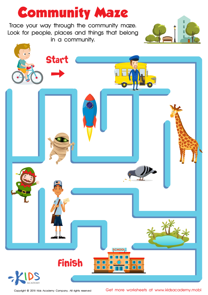
Community Maze Worksheet
Your kids will have a blast as they use their fine motor skills to trace their way through the community maze worksheet. Plus, they'll enjoy meeting people, places, and creatures to sort out who and what belong in a community and who and what don't! Help their friend bike to the neighborhood school and reinforce what life is like in a community.
Community Maze Worksheet
Worksheet

Seven Continents Worksheet
Geography teaches kids about the world! Encourage exploration with a seven continents worksheet - it'll help your child identify each continent using fun shapes.
Seven Continents Worksheet
Worksheet

World Continents Worksheet
Help expand your child's knowledge of the world with this fun worksheet! It features goofy shapes to identify each continent, making learning the seven continents fun and memorable.
World Continents Worksheet
Worksheet
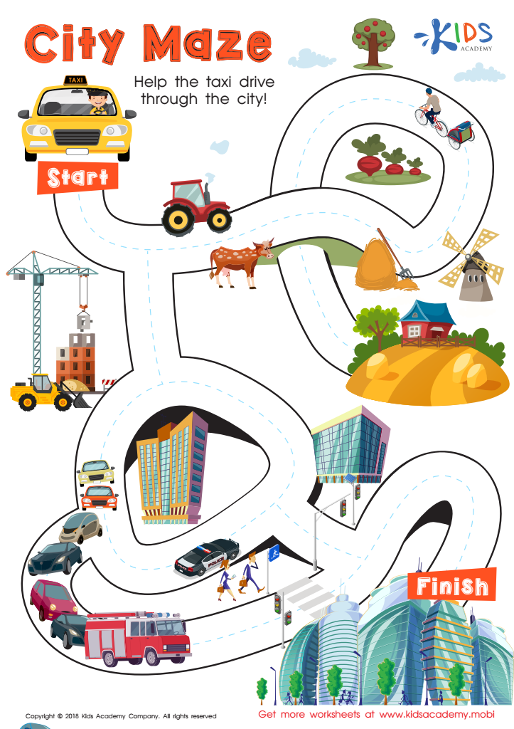
City Maze Worksheet
Kids love mazes! This free PDF city maze worksheet is sure to be a hit. Help your friend the taxi driver get through the maze, following traceable lines through different communities to the big city. It's a fun and challenging way to practice fine motor skills and succeed!
City Maze Worksheet
Worksheet

US Regions Coloring Page Worksheet
Our great nation is split into five distinct regions: Southeast, Southwest, West, Midwest, and Northeast. Each is known for its own special offerings and states. Let your kids have fun learning about the regions with a coloring activity! It's a great way for them to understand where each region stands on the map.
Download (PDF)
 Assign to My Students
US Regions Coloring Page Worksheet
Worksheet

Cardinal Directions Printable
Perfect for fall, let's go to Transylvania with Count Dracula to learn cardinal directions. This printable worksheet introduces the compass rose and offers valuable practice. Kids will love the fun vampire theme! Get them motivated and help them discover the world with this spooky worksheet.
Cardinal Directions Printable
Worksheet

Towns Worksheet
Towns are generally quiet and safe, making them attractive for young families. Cities have more people, businesses and tall buildings. Roads are busy, and there is often plenty to do and see. Help your kids check which pictures in this worksheet show towns.
Towns Worksheet
Worksheet
Join Kids Academy for Free
Who is primarily going to use this learning content?


Map reading skills in social studies are essential for children aged 4-6 because they lay the foundation for important cognitive and analytical capabilities. At this early stage, kids are naturally curious about their surroundings, and introducing them to maps helps them understand spatial relationships and geography in an engaging way.
First, map reading accelerates cognitive development by enhancing children's ability to process information about locations, distances, and directions. This spatial awareness is critical not only for geography but also for foundational math skills like geometry. Additionally, understanding maps instills early problem-solving skills as children learn to interpret symbols and navigate simple routes.
Second, exposure to maps enriches children's understanding of the world's diversity. They learn about different countries, cultures, and landmarks, promoting empathy and cultural awareness. This early exposure helps form a globally-informed mindset, which is invaluable in today’s interconnected world.
Third, teaching map reading captures children’s imagination and can make learning interactive and fun. Activities such as treasure hunts using simple maps make education a delightful experience, fostering a lifelong love for learning.
In sum, integrating map reading in early social studies cultivates a versatile skill set that benefits children academically and personally, providing them with powerful tools to navigate their world.