Map reading skills Geography Worksheets for Ages 6-9
7 filtered results
-
From - To
Transform your child's understanding of geography with our engaging Map Reading Skills worksheets designed for ages 6-9! These fun and interactive resources help young learners develop essential map-reading abilities, from identifying directions and landmarks to understanding map symbols and scales. Each worksheet is crafted to encourage critical thinking and spatial awareness, making geography both accessible and enjoyable. Perfect for classroom use or homeschooling, our worksheets promote hands-on learning through captivating activities that spark curiosity about the world. Equip your child with foundational skills in navigation and geography, and watch them explore the possibilities that effective map reading can offer!

5 U.S. Regions Worksheet
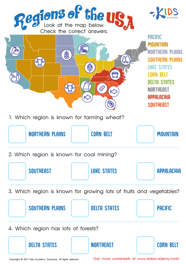
Regions of the USA Worksheet

Seven Continents Worksheet

World Continents Worksheet

US Regions Coloring Page Worksheet

Cardinal Directions Printable
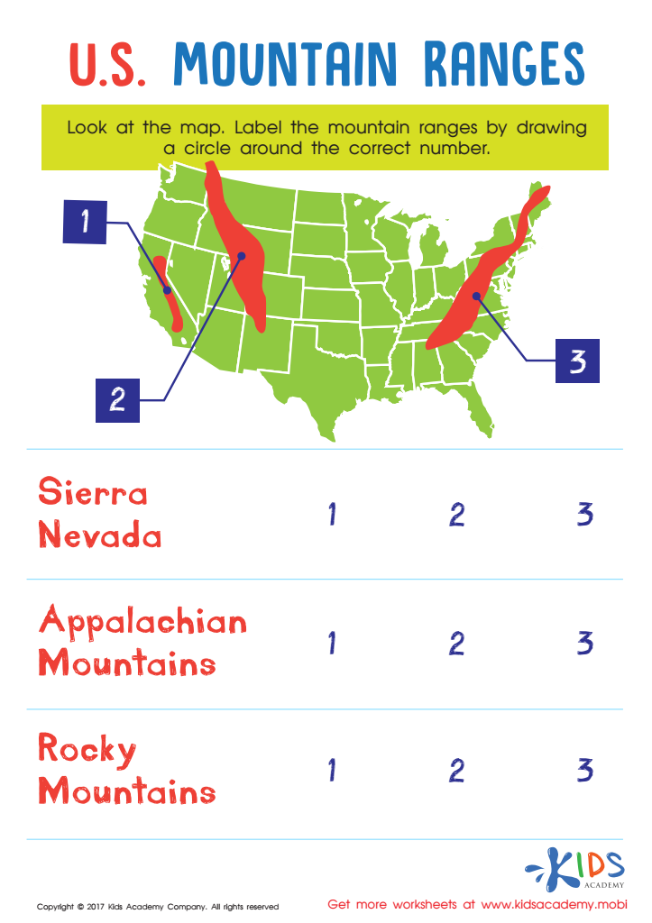
US Mountain Ranges Worksheet


Map reading skills are essential for children aged 6-9 as they foster critical thinking, spatial awareness, and a sense of belonging. Understanding maps nudges young learners to engage with their environment, encouraging curiosity about geography and the world around them. This foundational skill helps children locate places, recognize landmarks, and understand directions—tools that enhance their ability to navigate both locally and globally.
Furthermore, map reading skills promote problem-solving abilities. By interpreting symbols, scales, and legends, children learn to decipher information visually, a skill they will use throughout their education and in everyday life. This can lead to improved academic performance, especially in subjects like math and science, which often rely on spatial reasoning.
Additionally, map reading can spark interest in other subjects, such as history and culture. Exploring maps tied to different regions enables kids to appreciate diversity and global communities, cultivating empathy and understanding from a young age.
Ultimately, parents and teachers play a crucial role in instilling these skills. By encouraging map-reading activities—like scavenger hunts or trips to parks—adults can support children's cognitive and social development, helping them grow into informed and engaged citizens.