Map reading skills Geography Worksheets for Ages 4-8
7 filtered results
-
From - To
Empower your young explorers with our Map Reading Skills Geography Worksheets, designed specifically for ages 4-8. These engaging worksheets, available on Kids Academy, introduce children to basic map symbols, directions, and key reading skills through fun, interactive activities. They will learn how to navigate maps, understand legends, and identify different places, cultivating a love for geography. Perfect for early learners, our worksheets make geography exciting and accessible, enhancing critical thinking and spatial awareness. Give your child the keys to the world with our expertly crafted resources. Start their journey in map reading today!

5 U.S. Regions Worksheet
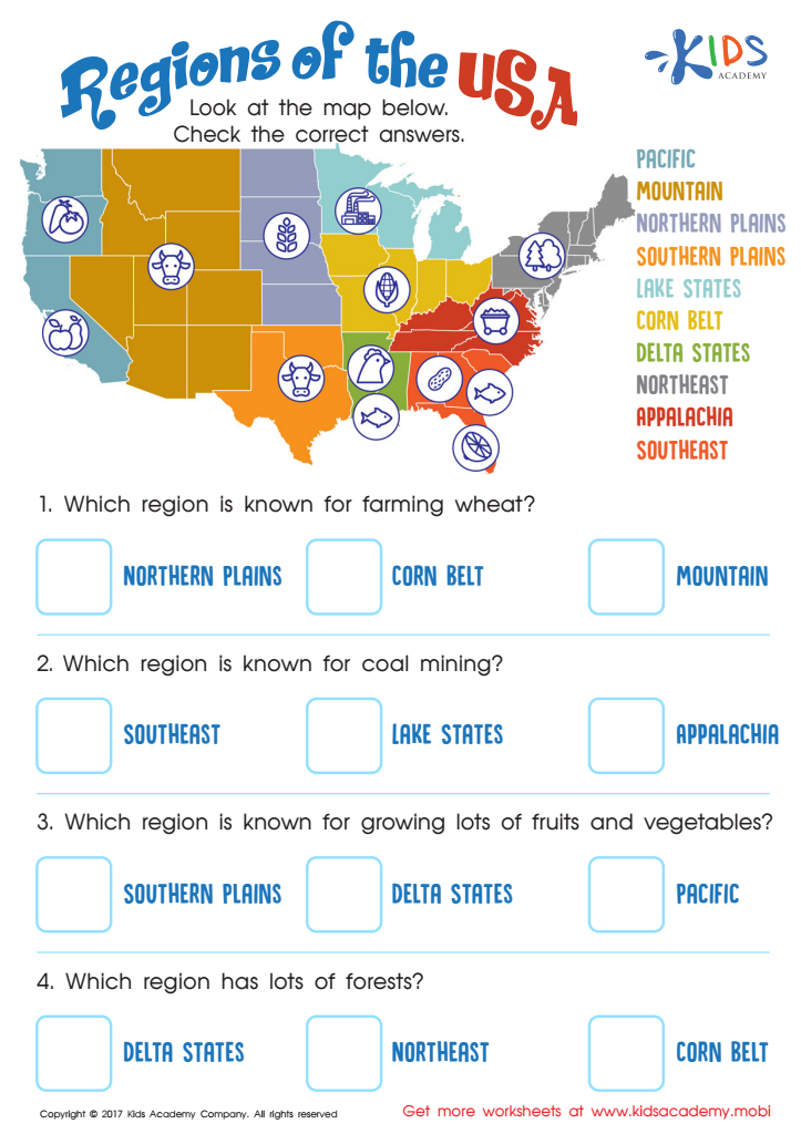
Regions of the USA Worksheet

Seven Continents Worksheet

World Continents Worksheet

US Regions Coloring Page Worksheet

Cardinal Directions Printable
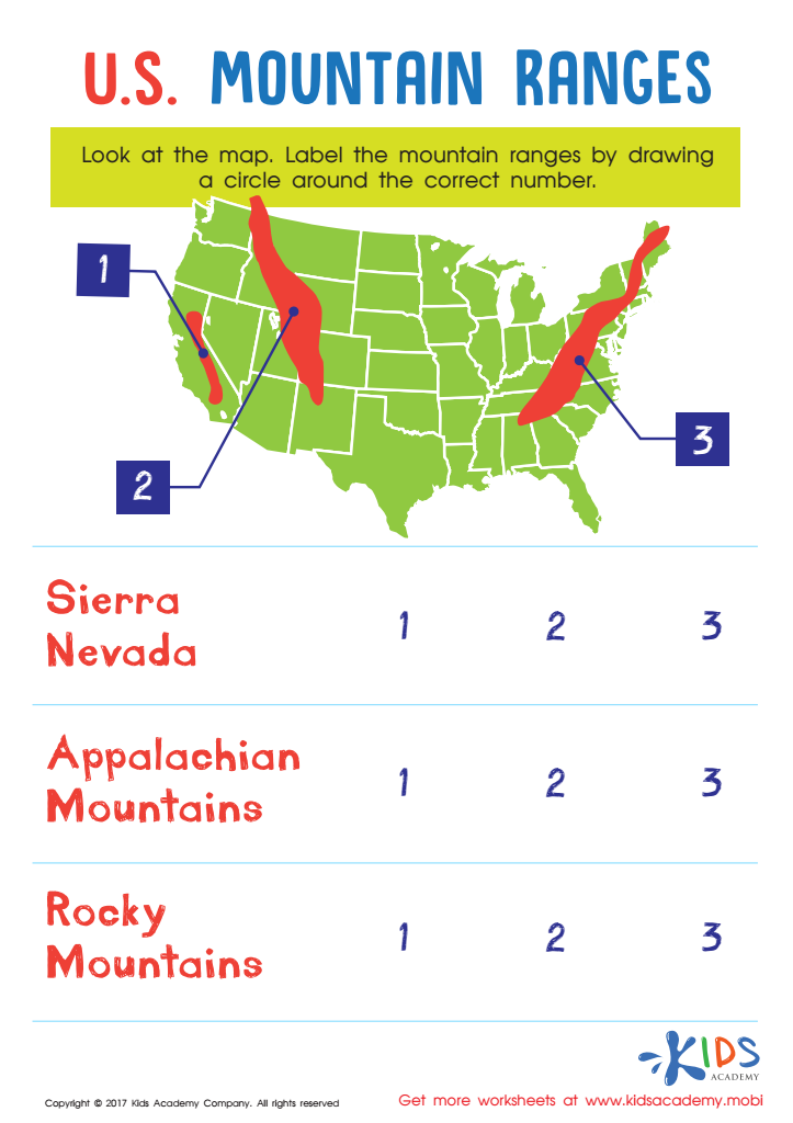
US Mountain Ranges Worksheet


Map reading skills in geography for children aged 4-8 are fundamental for several reasons. Firstly, these skills lay the foundation for spatial awareness, helping children understand their physical world. By recognizing symbols and comprehending scales, young learners develop cognitive abilities to gauge distance and direction, crucial for their overall intellectual development.
Secondly, geography fosters a sense of curiosity and exploration. When children learn to read maps, they start appreciating different places and cultures, fostering global awareness and empathy. This understanding of the world encourages open-mindedness and acceptance, important values in an interconnected age.
Additionally, map reading enhances critical thinking and problem-solving skills. As children decipher maps, they engage in exercises that promote analytical thinking and decision-making. For instance, understanding how to navigate a map can help them plan simple routes, a skill transferable to various life situations.
Moreover, early exposure to geography and map-reading sparks an interest in STEM (Science, Technology, Engineering, Mathematics) fields. Geo-literacy can lead to interests in subjects like environmental science, urban planning, and even technology applications like GPS systems.
In essence, integrating map-reading skills in early education cultivates a well-rounded, intellectually curious, and compassionate young individual, equipped with practical and cognitive tools to navigate an ever-evolving world.