Map reading Social Studies Worksheets for Ages 6-8
3 filtered results
Difficulty Level
Grade
Age
-
From - To
Subject
Activity
Standards
Discover engaging map reading social studies worksheets designed for ages 6-8 at Kids Academy! Our interactive printables help young learners master essential map skills, from understanding symbols and directions to locating continents and identifying landmarks. Each worksheet is crafted to build critical thinking, spatial awareness, and problem-solving capabilities. Fun activities and colorful illustrations ensure children stay motivated while they navigate the world of maps. Ideal for both classroom and home use, our resources lay the foundation for geographical literacy and foster a lifelong curiosity about the world around them. Start your child's learning journey today!
Favorites
With answer key
Interactive
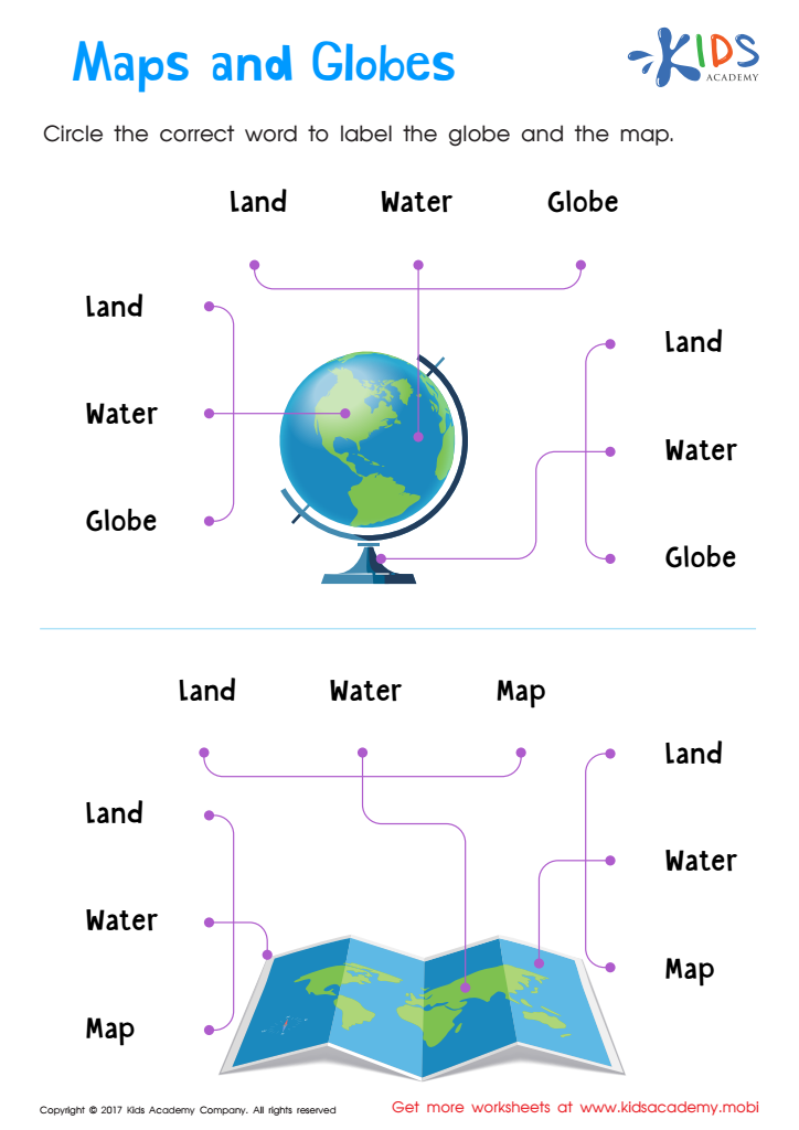
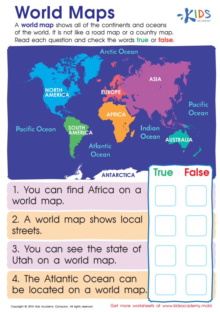
World Maps Worksheet
Help your young geographer learn about world maps. Show them that it displays all the oceans, continents and is distinct from other maps. Challenge them to answer the true/false questions on this free worksheet, and help them become a global citizen who understands the purpose of world maps.
World Maps Worksheet
Worksheet
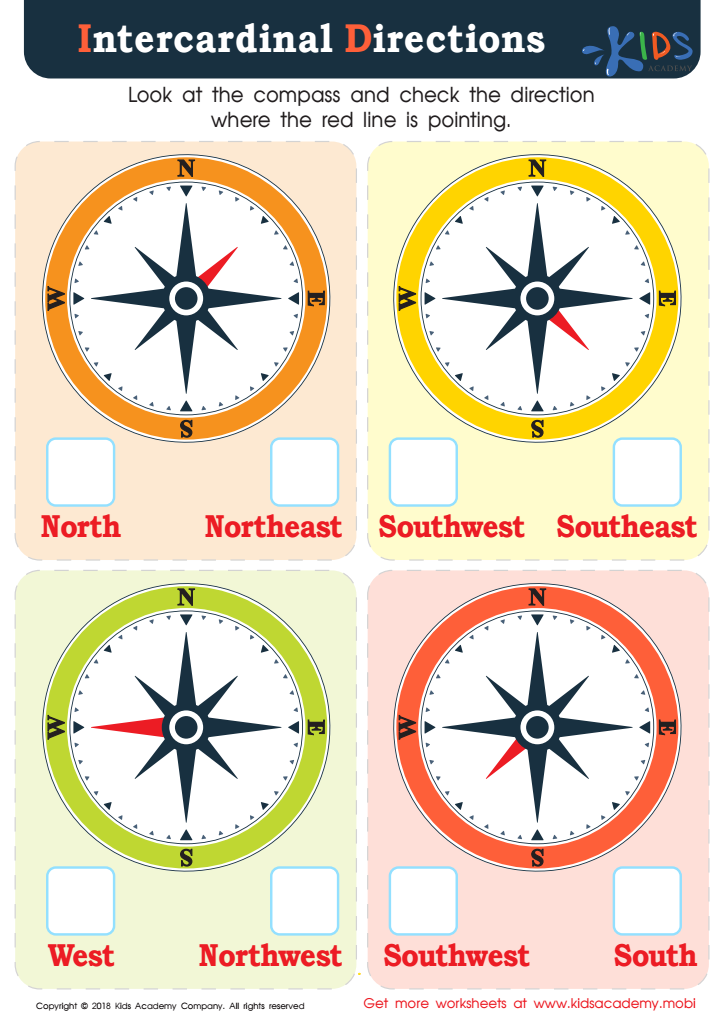
Intercardinal Directions Worksheet
Young students often don't get to practice cardinal and intercardinal directions in the digital age, but it's an important social studies and geography concept to learn. This PDF provides colorful compasses for them to practice with, giving them a real-world skill for common curriculum and independent living.
Intercardinal Directions Worksheet
Worksheet
Join Kids Academy for Free
Who is primarily going to use this learning content?


Map reading is a crucial skill for young learners aged 6-8 because it serves as a foundation for understanding the world and their place in it. First, it supports spatial thinking, an important cognitive skill that helps children understand geographical relationships and visualize objects and spaces in their mind. This kind of thinking is not only beneficial in geography but also in fields like math, science, and engineering.
Second, learning to read maps enhances a child's ability to comprehend and solve problems. For instance, following routes and understanding directions promotes logical thinking and problem-solving skills, which are useful in everyday life as well as in academic settings.
Additionally, maps introduce children to a variety of key social studies concepts, such as locations, distances, and geographical features. Knowledge of these concepts broadens their understanding of history, cultures, and current events, providing a well-rounded education that fosters global awareness and empathy for people in different parts of the world.
Teachers and parents who prioritize map reading impart valuable lifelong skills and help cultivate a generation of well-informed, inquisitive, and thoughtful individuals. Given the early age when children's brains are highly adaptable and receptive to new knowledge, encouraging map reading during this critical period can lead to sustained academic curiosity and achievement.