Map reading Social Studies Worksheets
3 filtered results
-
From - To
Explore our engaging "Map Reading Social Studies Worksheets," designed to help young learners develop essential map-reading skills. These interactive worksheets introduce concepts such as map symbols, scales, cardinal directions, and identifying landforms, ensuring students gain a solid understanding of how to read and interpret maps. Tailored for early grades, these resources combine fun activities with educational content, making geography accessible and enjoyable. Whether in the classroom or at home, our printable worksheets encourage critical thinking and enhance spatial awareness. Equip your students with the tools they need to navigate the world around them effectively. Start mapping their learning journey today!
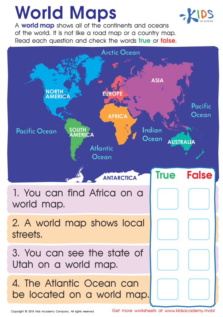
World Maps Worksheet
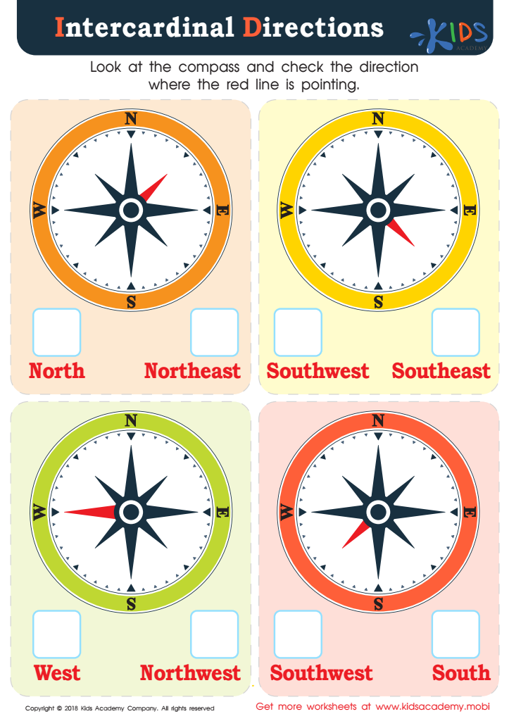
Intercardinal Directions Worksheet


Map reading is a vital skill that harbors numerous benefits for students, making it an important focus for parents and teachers alike in Social Studies. Firstly, map reading enhances spatial awareness, allowing children to better understand the world around them. It fosters skills such as critical thinking, as students learn to analyze various geographical features, symbols, and scales.
Furthermore, map reading connects students to their local communities and the broader world. By interpreting different types of maps—physical, political, or thematic—students gain insights into cultural, historical, and economic contexts, helping develop global awareness. This understanding is essential in an increasingly interconnected world, where geographical literacy can influence children's ability to engage in meaningful discussions about current events.
Moreover, mastering map skills builds confidence and independence in navigating unfamiliar environments, significantly contributing to personal development. Parent and teacher involvement in encouraging map reading fosters a lifelong appreciation for geography and the skills necessary for informed citizenship. Collectively, by emphasizing map reading in Social Studies, we equip students with essential tools to understand and interact with the world effectively, making their education richer and more relevant.