Understanding equator Worksheets for Kids
1 filtered results
-
From - To
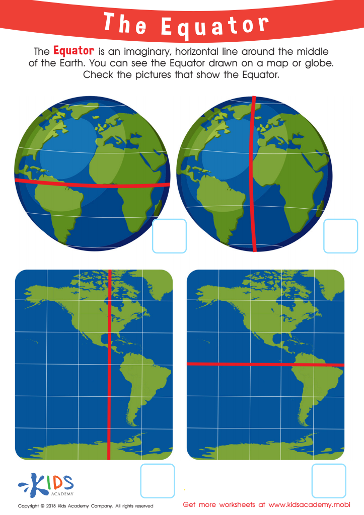
The Equator Worksheet
Question/Answer
What are some effective activities to train students’ Understanding equator skill when teaching them about Geography?
To train students' understanding of the equator in Geography, engaging activities include creating interactive globe models to visualize equator location, playing latitude and longitude treasure hunts that emphasize the equator's role, conducting temperature comparison studies between equatorial and non-equatorial locations, and utilizing map drawing exercises to identify equatorial countries.
How to train the Understanding equator skill in Grade 3 students learning about Geography?
To train Grade 3 students in understanding the equator, use a globe or world map to visually demonstrate its location as the imaginary line dividing the Earth into Northern and Southern Hemispheres. Engage them in hands-on activities like drawing the equator on a map or globe and discussing the significance of climate differences above and below the equator.
How to test a Grade 3 student’s Understanding equator skills?
To test a Grade 3 student's understanding of the equator, you can ask them to identify the equator on a globe or a map, explain what the equator is, and describe its significance in terms of climate and day length. Additionally, you could have them list countries or continents that the equator passes through to assess their knowledge.


.jpg)