Understanding latitude and longitude Worksheets for Kids
1 filtered results
-
From - To
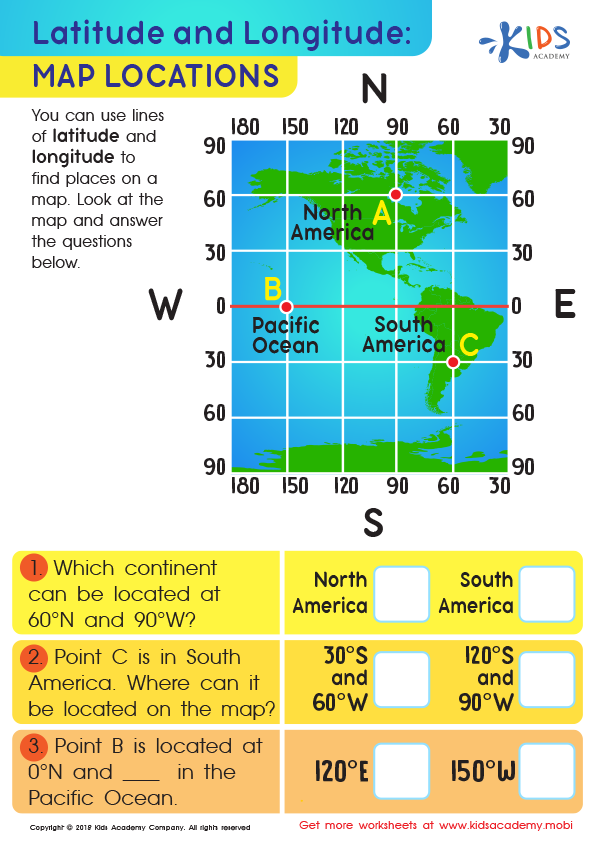
Latitude and Longitude: Map Locations Worksheet
Question/Answer
How to test a Grade 2 student’s Understanding latitude and longitude skills?
To test a Grade 2 student's understanding of latitude and longitude, provide a simple map with clearly marked lines of latitude and longitude. Ask the student to identify specific locations using the coordinates given or vice versa. Include basic questions like identifying the equator or prime meridian, ensuring tasks are age-appropriate with visual aids and guided examples.
How does the mastery of the Understanding latitude and longitude skill affect a student's performance at an early age?
Mastery of understanding latitude and longitude at an early age significantly enhances a student's geographical skills, spatial thinking, and global awareness. It improves their ability to locate places accurately on a map, understand the concept of time zones, and navigate using coordinates. This foundational knowledge sets the stage for advanced study in geography, science, and history, boosting overall academic performance.
How to train the Understanding latitude and longitude skill in Grade 2 students learning about Geography?
To train Grade 2 students in understanding latitude and longitude, start with simple, age-appropriate explanations of both concepts. Use globes and maps for visual aid. Employ engaging activities like locating famous landmarks or their own city using coordinates. Incorporate storytelling to make abstract concepts relatable, and practice with fun, interactive games or crafts to reinforce their learning and maintain interest.